Mapbox Satellite gets 48TB facelift
By Chris Herwig
We just added 48 terabytes of updated aerial imagery for the entire continental United States. Starting today users will see the updated imagery at zoom levels 13–17 on Mapbox Satellite

We just added 48 terabytes of updated aerial imagery for the entire continental United States. Starting today users will see the updated imagery at zoom levels 13–17 on Mapbox Satellite. The new imagery is beautiful — and it’s all made possible by open data from the USDA’s National Agriculture Imagery Program.
Our image processing pipeline, built on top of Amazon Web Services’ cloud infrastructure, ingested the 24 hard drives worth of orthoimagery and perform a series of image calibration and adjustment routines to produce a seamless mosaic basemap that is fast, accurate, and beautiful. We’ll be going into more detail about the processing pipeline and how this relates to Satellite Live in a few days.

The west side of downtown Portland, Oregon, borders steep hills. On the left side of this view you can see Sunset Highway entering the Vista Hills Tunnel, and the switchbacks of residential roads. To their north, on the edge of this image, is Providence Park, home of the Portland Timbers soccer team. On the right you can see the green strip of the downtown park blocks, and just northeast of them is Pioneer Courthouse Square, “Portland’s living room”, paved in salmon-colored brick.

Crater Lake, the deepest lake in the United States, is famous for its rich blue color. It was created by a huge volcanic eruption about 7,700 years years ago in what’s now southern Oregon. Near the west edge of the lake is Wizard Island, a volcanic cone with its own relatively small crater — a mere 150 meters or 500 feet across. The image shows a range of colors in the volcanic rocks, the shapes of wind currents forming ripples on the surface of the water, and some tiny patches of snow.

Fort Baker, just across the Golden Gate Bridge from San Francisco in Marin County, was once used to guard the Bay from naval attack. It’s also a future home of Starfleet Headquarters. In the left of the image are footpaths in the Marin Headlands.
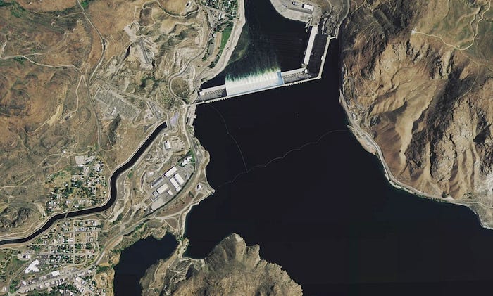
The Grand Coulee Dam, on the Columbia River in Eastern Washington, is the largest power plant in the United States. It was originally built as a New Deal project in the Great Depression, and was upgraded in the 1970s. Its reservoir supplies water to a vast area of farmland growing apples, wheat, and other crops.
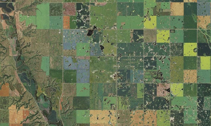
The small lakes and wetlands in the Prairie Pothole Region are surrounded by fertile land in the Dakotas, Wisconsin, and Minnesota. More than half of North America’s migratory waterfowl pass through the region each year. Many of the potholes have been drained and their land converted to fields for oats, beans, corn, mustard, peas, wheat, and other crops, giving the area a colorful patchwork look.
Today’s rollout includes the most recently captured NAIP imagery available, with half captured within the past year and all but three states captured in the past 2 years.
- 2013: Alabama, Arizona, Arkansas, Colorado, Delaware, Florida, Georgia, Idaho, Iowa, Louisiana, Maine, Maryland, Minnesota, Montana, Nevada, New Jersey, New York, Ohio, Oklahoma, Pennsylvania, South Carolina, Washington, Wisconsin
- 2012: California, Connecticut, Illinois, Indiana, Kansas, Kentucky, Massachusetts, Michigan, Mississippi, Missouri, Nebraska, New Hampshire, North Carolina, North Dakota, Oregon, Rhode Island, South Dakota, Tennessee, Texas, Vermont, Virginia, Wyoming
- 2011: New Mexico, Utah, West Virginia
Recency in action
This new imagery is available for feature extraction for both the OpenStreetMap community and Mapbox Commercial Satellite users. Here are a few examples of the many ways that recency matters to our users. (Left: Before, Right: After)
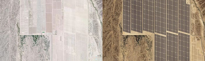
Completed in April 2014, The Agua Caliente Solar Project in Arizona is the largest solar project in the United States to date, and now visible fully from Mapbox Satellite.
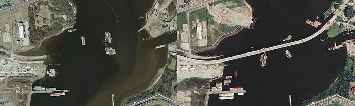
Completed in October, 2012, the new South Norfolk Jordan Bridge, in Norfolk, VA, is now shown in its finished state.
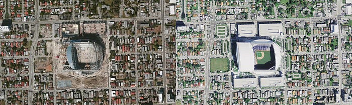
Construction on Marlins Park in Miami, Florida, completed in March 2012. Mapbox Satellite now shows the finished stadium with its retractable roof opened.
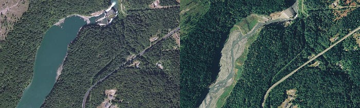
The Elwha Dam, on Washington State’s Olympic Peninsula, was demolished in 2011. What used to be its lake is turning into meadows and sandy riverbanks.
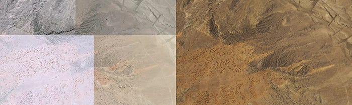
Updated imagery, in combination with our image calibration and adjustment pipeline, reveals a vastly different depiction of the Chihuahuan Desert near Albuquerque, New Mexico.

