Mapbox terrain data update
By Matt Greene
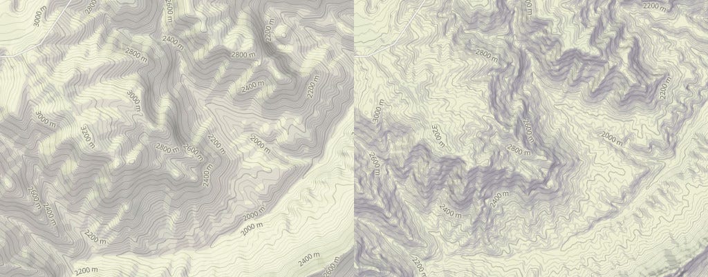
We just pushed a huge data update to Mapbox Outdoors, increasing terrain resolution across nearly 70 countries and significantly improving our map design. Check out the side-by-side comparison showing the new terrain data in Mapbox Outdoors. On the left is our first version and on the right is today’s release:
Explore the full map here.
Elevation contours from NEXTMap
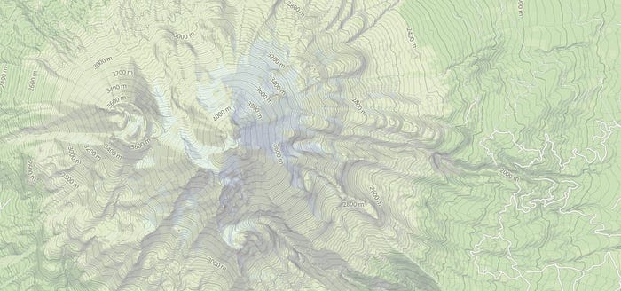
We are now using Intermap’s NEXTMap Digital Terrain Model for the majority of the U.S. and Western Europe, offering incredible 5 meter resolution and 1–3 meter vertical accuracy. With this new data we’ve improved the detail in our shaded relief and elevation contours by up to 100% in the United States. Better still is Western Europe where we’ve increased the detail in many areas, including a 1700% increase in the Alps.

v1 vs v2: This view of the Alps shows our updated hillshade design plus higher resolution data combined to provide stark ridges and slopes.
SRTM 30m Global
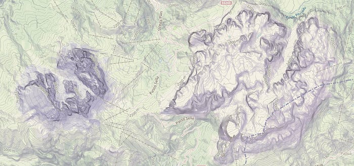
The U.S. government recently began publishing 30-meter elevation data from the Shuttle Radar Topography Mission-Level 2 (SRTM-2). This will triple the DEM quality for a large portion of the globe where until now 90-meter SRTM was the best available. We have already updated most of Africa and plan to take full advantage of this dataset as fast as it is made available. Similar improvements will be coming very soon for South America, Asia, and Australia.
v1 vs v2: Newly-released 30-meter SRTM data gives us a more detailed look at the Ethiopian highlands.
Better Hillshades & Contours
In addition to data, we’ve updated our vectorization process in order to bring design and detail improvements to the whole planet. Shading in this new version includes twice as much shadow detail and is based on a combined hill-shading and slope-shading technique that allows for better emphasis in areas of steep terrain.
Contours in today’s launch have also been reworked into stacked polygons rather than lines. This gives the map designer the option of applying elevation-based colors or patterns to the terrain, as well as the standard contour lines and labels.

What the latest terrain data looks like in Mapbox Studio Classic’s data inspector.
Check out our updated vector tile documentation and Mapbox Studio Classic styling manual for full details on using Mapbox Terrain in your own custom maps. We’ll blog in a few days more detail on the various ways this new terrain data can be styled in Studio.

Grand Canyon National Park, Arizona, USA. Sourced from 5m NEXTMap.
Mount Shasta, California, USA. Sourced from 5m NEXTMap
Dolomites, Italy. The extremely steep cliff faces are captured well by the slope-shading. Sourced from 5m NEXTMap.
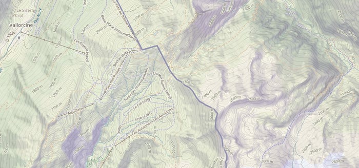
Skiing in France, hiking in Switzerland in the Alps. Sourced from 5m NEXTMap.
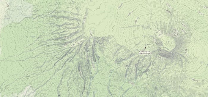
Mount Kilimanjaro National Park, Tanzania. Sourced from 30m SRTM.

