Rand McNally: a new map and a peek into the design process
Rand McNally just rolled out a beautiful new map that makes the atlas that you grew up with in your glove compartment the atlas on your iPad. The 158-year-old company defined an era of cartography — we all grew up consulting their maps on road trips around the country — and now the team at Rand McNally has created a vector map that mimics the handmade, tactile atmosphere of the Rand McNally brand.

The map launches with Natural Earth raster tiles at low zoom levels and, as you zoom in, reveals modernized, blended layers of styled vector data inspired by the company’s traditional watercolor blends and proprietary color palette. Here’s a peek into the design process for the Rand McNally vector map in Mapbox Studio Classic.
Styling the data in Studio
Working with the team at Rand McNally, I began by creating a color palette based on traditional print maps.

I made a strong hierarchy in state and major city labels while contrasting thick white administrative lines for a quick read of place. I then pulled out the major highways with a vibrant but soft blue that plays with the connecting points for road-bound explorers.
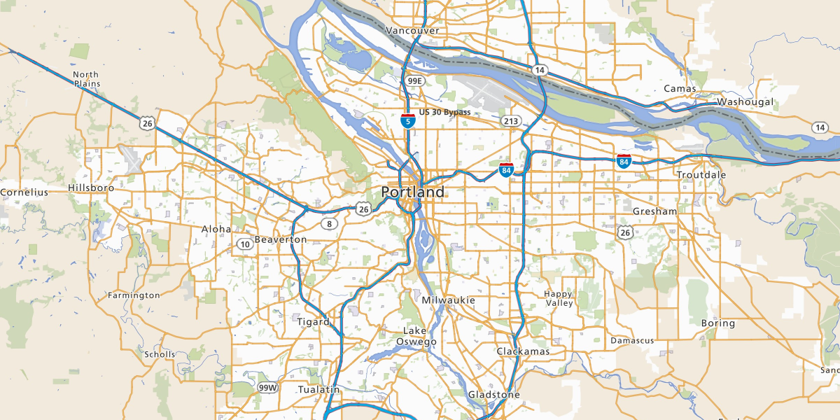
Highway shields come into play when viewing cityscapes and indicate connections from place to place. I replicated the symbolic shape you see on the Rand McNally print maps, reflecting the signs you see from your vehicle on the road. I used contrasting white land coverage to emphasize the subtle red main roads and vibrant blue highway details, all juxtaposed against light grayscale relief separated by softer but still prominent state boundaries.

Finally, at street level, I added a hierarchy of color and scale in labeling and line thickness to continue ease of use for navigation.
The team at Rand McNally incorporated US census polygons, additional highway shields, exit numbers and other data sources while also adjusting colors, fonts and lines to produce a final digital map that resembles the printed Rand McNally Road Atlas maps trusted by travelers for almost a century.
Explore the final map at Rand McNally’s TripMaker.