Strava launches gorgeous new outdoor maps
Maps designed by athletes, for athletes
By: Eric Gundersen
I run with Strava wherever I am in the world, and they just launched new maps with stunning cartography — a totally custom, modern-minimalistic style designed to highlight the details runners and cyclists love to see. It’s a next-level way to share the ground I’m covering with millions of other Strava athletes around the world while pushing my pace in new places to make sure I keep running hard.
On Strava, athletes can track every activity, understand where they’re pushing themselves and do a post-workout deep dive on their data. It’s not just about the run or ride — it’s about sharing how far we’re pushing, cheering on friends, and going further together. I love following all of the activity in my feed, seeing what others are doing and how they’re performing, and get excited discovering new routes and terrains around the world visualized on the map.

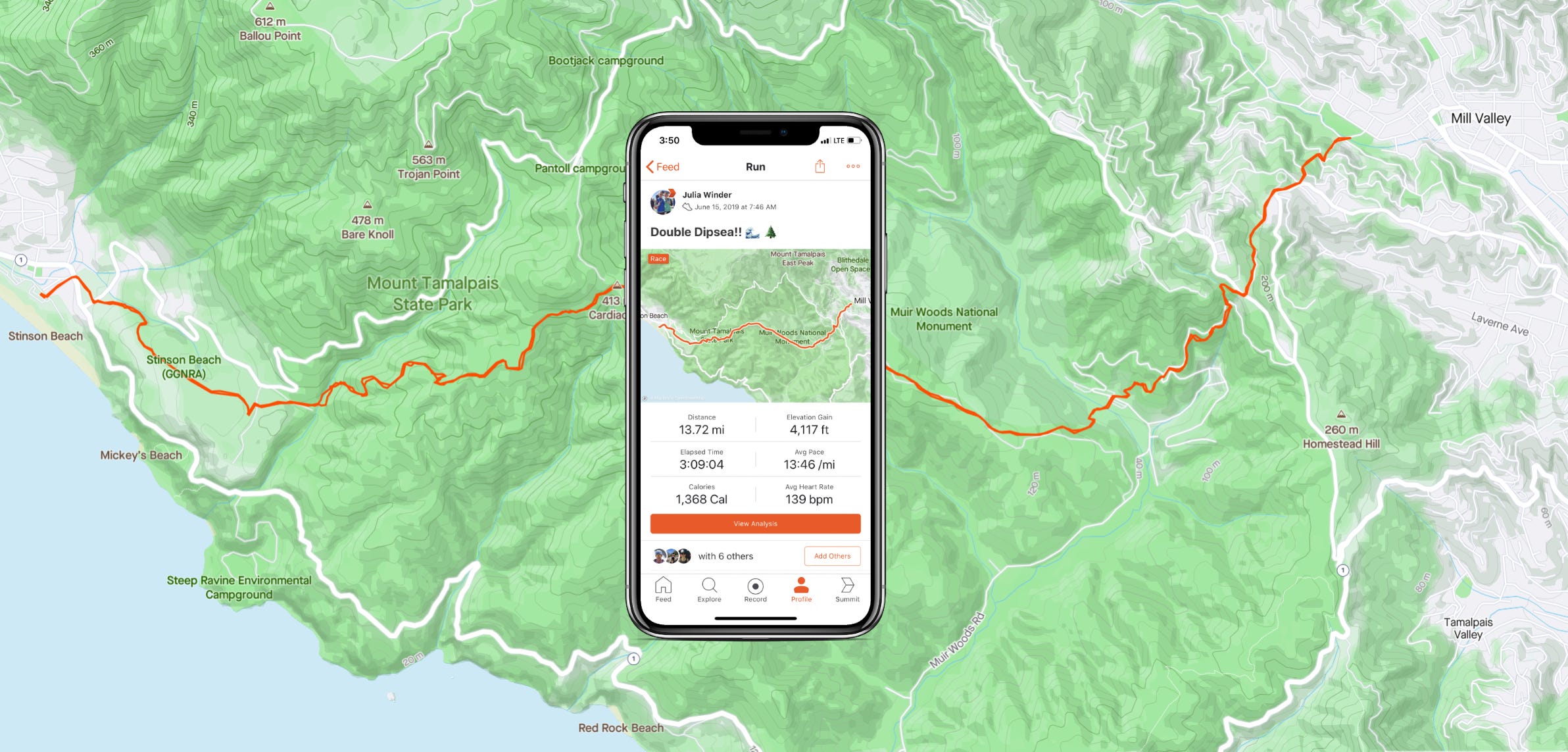
In designing the map, the team focused on one goal: ensuring the map accurately reflected an athlete’s journey. They designed it to be clear when an athlete powered up a steep hill, ran by the edge of a river, through a canyon, or along the beach — and wanted to give athletes a feeling of joy reflecting back on that moment they made it to the summit. They’ve made it easier to visually share the stories of our routes, terrains, and wins.
“We are thrilled to share this significant upgrade with our members, with more terrain detail and improved accuracy and aesthetics for how GPS tracks appear. Mapbox is a mapping leader, and we’re excited about the athlete-optimized map that our two teams created for the global Strava community.” — James Quarles, Strava CEO


The update highlights terrain with a minimalistic style so activity stands out. Most maps are optimized for cars, but Strava’s new maps purposefully de-emphasize car-oriented features like highway numbers in favor of trail names, elevation contours, and smooth traces of GPS activity.


Strava’s new maps make me want to run and it will be awesome sharing these stunning routes and seeing all the styles in my Feed. If you’re already a Strava user, update your app to see the new features, or download on iOS and Android to join the community.
If you want to create maps to highlight terrain, routes, or activities, create a free account and start building.

