Open data for mapping wildfires, smoke, and air quality
New Mapbox blog posts are now published on www.mapbox.com/blog. Leave your email to receive email updates when new posts are published or subscribe to the new RSS feed.
The western United States is in the middle of an unprecedented fire season. For populations impacted by these wildfires and their smoke, maps are increasingly important tools for staying safe.
Use the open data resources listed here to build your own maps of fires and air quality.
US wildfires data sources
Fire perimeters (latest known extent of where the fire has burned) and points (single point for an active fire location)
- National Interagency Fire Center (formerly GeoMAC) is the central source of truth.
- InciWeb hosts an RSS feed that is updated multiple times a day — learn more about working with this data source.
- WIFIRE Project includes data sources for historical perimeters, weather, wind and gusts, estimated fuel, and wildfire cameras.
Fire origins (estimate of where the fire started)
- National Interagency Fire Center (formerly GeoMAC)
- CalFire provides incident data in JSON and GeoJSON formats.
Hotspots (areas suspected to be on fire according to satellite imagery analysis)
- National Oceanic and Atmospheric Administration (NOAA) Hazard Mapping System Fire and Smoke Product (human reviewed, sourced from NASA satellites).
Evacuation zones
- Official evacuation zones are reported by individual county governments.
- The InciWeb RSS feed includes some announcements of evacuations and road closures.
Satellite imagery
- Imagery is often available from NOAA and NASA.
- Commercial providers like Maxar and Planet may also release imagery for major fires.
Smoke and air quality
- To visualize smoke plumes try NOAA fire and smoke products.
- Purple Air provides JSON data from its crowdsourced air quality sensors (note that the LRAPA conversion is recommended for wildfire smoke).
- AirNow provides data on real-time air quality observations from over 2,000 monitoring stations and collects forecasts for more than 300 cities.
- OpenAQ provides open data on air quality measures across the US and around the world.
International data sources
In addition to the devastation in the US, Australia’s fire season is about to begin and we’re already seeing a repeat of devastating fires in the Amazon.
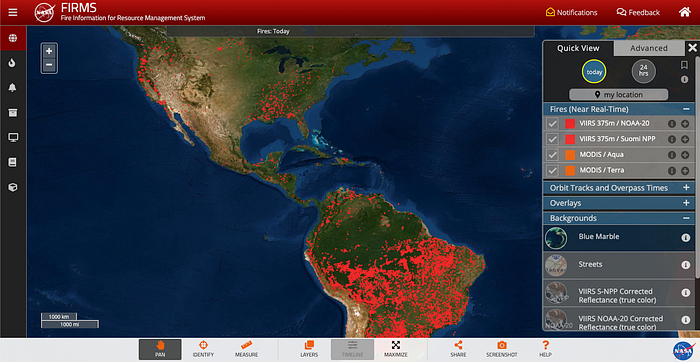
- NASA provides near real-time fire monitoring data from their MODIS and VIIRS satellites and maintains a collection of imagery and other data products for wildfires.
- Australia: Bushfire.io integrates data from multiple public data sources.
- Portugal: Fogos.pt uses data from the Portuguese Institute for Sea and Atmosphere.
If you know of other data sources please contact the Mapbox Community team.
Documentation for using third-party data sources with Mapbox:
- GeoJSON source, or for iOS
- Live real-time GeoJSON source, or for iOS and Android
- JSON source (join to spatial data), or for Android
- Vector tile source, or for iOS
- Raster tile source, or for iOS
- WMS source, or for Android
- Swipe between maps to show before/after
If you are building for wildfire preparedness, response, or recovery, the Mapbox Community team is here to support.

